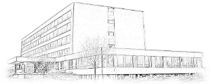
Department of geomechanics and mining research
The know-how of the department rest mainly in the development and application branch of mining research and rock engineering. It has years of experience gained from researching complex processes taking place in the rock mass and their impacts on the ground surface. The societal relevance of the department's research activities is demonstrated by the transfer of knowledge between the research and industrial sectors to share technical information related to the resilience and sustainability of rock engineering.
Research activity in the branch of geotechnical problems is focused on the detection and analysis of the primary and induced distribution of stress and deformation fields, which are formed both close to excavated underground spaces and close to of underground structures already at the time of construction and subsequently during their use. Evaluation of the long-term functional stability of underground workings, the evaluation of the level of safety at underground workplaces, as well as the evaluation of the level of effectiveness of the active and passive preventive measures used. Evaluation of the rock mass properties in relation to the needs of the deep disposal of spent nuclear fuel under the conditions of the Czech Republic (measurement of rock mass stresses, physical and mechanical properties of rocks, structure and quality of the rock mass, evaluation of the EDZ zone, etc.).
Research into the dynamics of the subsidence trough formation in connection with the rock mass failure in the overburden of mined seams and deposits in general is a highly topical topic today, especially in connection with the complete termination of deep mining. Part of the assessment of surface movements and deformations in the post-mining period is also the assessment of possible risks caused by geomechanical and rheological changes in the rock mass due to the flooding of closed mines with mine water.
Research activities in the field of laboratory methods are focused mainly on the study of physical, mechanical and deformation properties of intact rocks and the relationships between the texture, structure and composition of rocks and geomaterials and their mechanical, fracture and corrosion resistance on a macroscale. Laboratory research at the department also includes the study of uses of mining products, especially in the construction industry, based on the principles of the healthy environment and circular economy.
In the branch of using X-ray imaging techniques, research is being carried out on the nature of the porous space, especially with regard to its influence on the properties of the monitored material. Processes during mechanical loading of samples and the internal structure of rocks are also studied using computed micro-tomography in combination with petrographic methods.
Research in the branch of geophysics is focused on the study of seismic activity in the Silesian-Polish border region. The basis of the research is seismological observation activities and the determination of the seismic activity in potential deep storage locations, as well as research into the regularities of manifestations and sources of technical seismicity and seismic noise.
Application laboratory
- Laboratory of X-ray computer tomography (PDF, 108 kB)
- Automatic geodetic monitoring Automatic geodetic monitoring was designed for the purpose of obtaining measured data that will have sufficient frequency and quality for the evaluation of surface deformations in connection with deep mining. The monitoring was designed to record, at least partially, the main phase of the surface movements and subsequently the fading of the surface movements, which is estimated for a period of 5 years. Subsequently, in connection with the flooding of closed spaces with mine water, the surface will be uplifting. The realization of the monitoring system brought a whole range of non-traditional technical solutions, from the stabilization of the instrumentation itself, the placement and selection of the reflective system, to the processing of the measured data. By long-term monitoring of surface displacements, the data set needed for the development of a method for evaluating the mining effects after mine closure will be created.The trial operation of the monitoring was started in July 2022, the functionality of the system and its stability were tested with regard to the continuous transmission of measured data. In automatic mode, the position and height of two dozen surface points are measured every hour. Scanning of the seven monitored surfaces takes place automatically once a day. In manual mode, eight surface points are measured once a week.Monitoring instrumentation is stabilized on the roofs of the skip towers of CSM North and CSM South. The basis of the monitoring system on each of the skip towers consists of a Multistation, a GNSS sensor, a reflecting prism, a weather station, two accelerometers, as well as specialized software and equipment for online data transmission.


